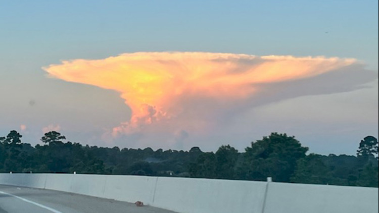
Have you ever looked up at the sky and seen what looks like an alien spacecraft trying to land? Chances are, you were gazing at an anvil cloud. While not necessarily rare, anvil clouds always provide a captivating spectacle in the sky.
But what exactly is an anvil cloud? When the rising updraft of air hits the tropopause, which marks the boundary between the troposphere and the stratosphere, it creates a stunning cloud formation that resembles an anvil. This unique shape is a result of the updraft spreading out as it hits the equilibrium level, where the air stops rising.
Imagine the anvil cloud as a mature thunderstorm, with updrafts and downdrafts interacting to create an expansive and striking cloud formation. The name “anvil cloud” is derived from its resemblance to the anvil tool used in metalwork.
While anvil clouds are not as rare as you may think, they can still vary in appearance and behavior. Some anvil clouds produce rain and thunderstorms, while others may remain harmless and simply add a touch of beauty to the sky.
Next time you spot an anvil cloud overhead, remember to appreciate the vertical movement of air that gives rise to this mesmerizing sight. And if you happen to capture a photo of an anvil cloud in the Houston area, don’t hesitate to share it through the Near Me feature of our app.
Ready to keep learning about weather phenomena? Explore more fascinating topics with our interactive content:

